La Niña Predicted for this Winter
According to the NOAA Climate Prediction Center, there is an 87% chance that La Niña conditions will persist in the Pacific Ocean this winter through February. La Niña generally causes mostly the opposite effects of El Niño: above-average precipitation across the northern Midwest, the northern Rockies, Northern California, and the Pacific Northwest’s southern and eastern regions.
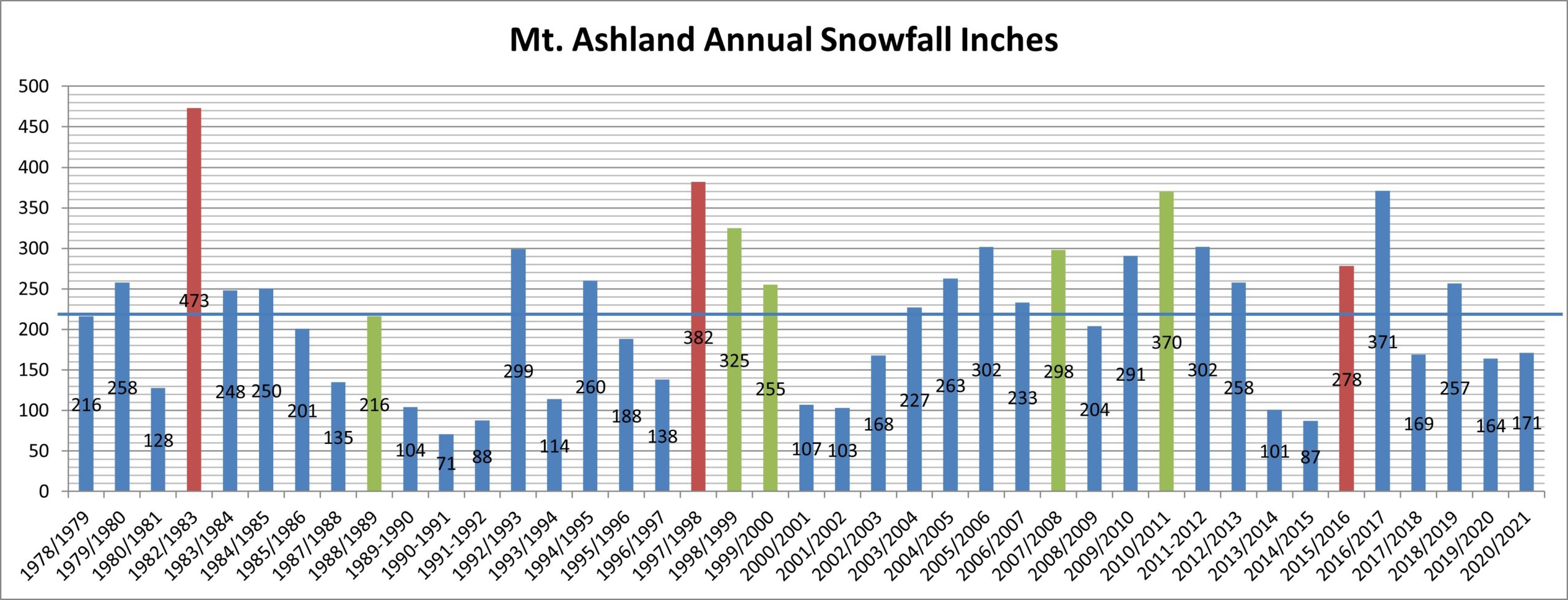
We don’t tie ourselves too much to such predictions in terms of guaranteed snowfall, but La Niña is a generally favorable condition for higher snowfall at Mt. Ashland. Since we began collecting snowfall data consistently in 1978, we have had 5 strong La Niña winters (1988-89, 1989-99, 1999-00, 2007-08, & 2010-11). During that time period, those winters have brought about 30% more snowfall than average at Mt. Ashland. If you just look at the last 20 years of data, strong La Niña winters have delivered 50% more snow.
In the chart above, you can see the accumulated snowfall each winter for the past few decades. El Niño winters are in red and La Niña winters are green. Neutral years are blue.
There is a lot of variability in the strength of the La Niña of course, so there is no guarantee. But it’s fun to dream of a snow-filled winter as we watch weather events visit the Rogue Valley on a more consistent basis this fall.
Guess it’s time to Pray for Snow!